
OUTDOOR SURVIVAL / TRAIL DECISIONS
You Hear Gunshots Near the Trail. What Should a Hiker Do Next?
A clear plan for hiking during hunting season—what to do when you hear shots, how to verify land access and seasons, and how to stay visible with the gear you actually carry.
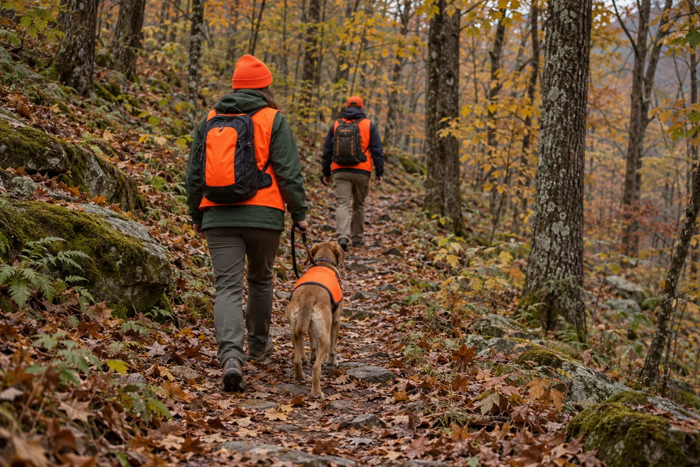
THE SHORT ANSWER
Stop advancing. Keep your group together. Decide whether you are in immediate danger.
If you hear distant shooting with no sign that anyone is firing toward you, make your presence known with a clear human voice, check your location and choose a route away from the activity. Do not walk toward the shots to investigate.
If bullets appear to be passing nearby, impacts strike around you, someone threatens you with a firearm or a person is injured, treat it as an emergency. Escape away from the danger if you can safely do so; otherwise seek substantial cover and call 911 when safe. Do not step into view to announce yourself to someone who appears to be attacking people.
U.S.-focused guidance. Routine shared-use advice draws on U.S. Fish & Wildlife Service guidance; the immediate-threat distinction follows FBI emergency guidance. A sound alone cannot establish whether shooting is lawful or whether your position is safe.
WATCH / AN ORIGINAL FIELD EXPLAINER
Hear shots. Pause. Make the next decision.
Our narrated video walks through route checks, visibility and the response to immediate danger. Original animation and AI-illustrated scenes, with synthetic narration and captions. This is an explainer, not incident footage.
Read the video transcript
You hear gunshots while hiking. Stop moving farther into uncertainty and keep your group together. For ordinary hunting activity without signs of an immediate threat, use a clear human voice to identify yourselves. Do not walk toward the shots to investigate.
An open trail is not the same as a no hunting area. Check each land parcel, current closures and the official season calendar. An old app route cannot override a closure. Know your return route before you start.
Wear conspicuous blaze orange on your outer layers. Check the hat, body and backpack from several directions. Keep permitted dogs leashed and visible too. Orange improves visibility, but it does not guarantee safety or excuse unsafe shooting.
If bullets appear to pass nearby, impacts strike around you or someone threatens people with a firearm, treat it as an emergency. Escape if you safely can. Otherwise seek substantial cover and call nine one one when safe. Do not expose yourself to announce your presence during an apparent attack.
There is no universal safe distance you can calculate from a gunshot. Recheck access, seasons, visibility and your exit plan. If you remain unsure, turn back using a known open route or choose another outing. The full guide includes a printable trip card.
You do not have to identify the gun before making a sensible decision
A shot interrupts the rhythm of a walk. Your next thought might be whether the sound came from the next ridge, a nearby field or somewhere behind the trees. It is tempting to stand there trying to solve it. You do not need to solve all of it before deciding to stop moving farther into an uncertain situation.
Hiking during hunting season starts with a practical distinction: sharing land with hunters is different from being exposed to dangerous shooting. Neither “it must be hunting” nor “every shot means an attack” gives you a useful plan. Respond to what you can actually observe, and leave room for what you do not know.
For shooting you hear without signs of immediate danger
- Pause the group. Keep children close and your dog leashed. Take out earbuds so you can communicate. Avoid sending one person ahead to find the source.
- Identify yourselves as people. A clear call such as “Hikers on the trail!” is more useful than trying to imitate an animal or silently slipping through brush. This is ordinary hunting-area advice, not an instruction to expose yourself during an attack.
- Check the map and signs. Find your trail junction, property boundary and known way out. Do not choose a direction solely because the sound seems louder on one side.
- Change the plan if needed. Turning back along a known, open route may be the simplest option. If that route leads toward the activity or has become unsafe, use a verified alternative rather than improvising a shortcut.
There is no reliable “wait five minutes and continue” rule. A quiet interval does not confirm that everyone nearby knows where you are. If you remain unsure, ending the hike is a reasonable decision; reaching the viewpoint does not outrank getting everyone home.
In an ordinary shared-use encounter, speak clearly, then be courteous once acknowledged. Nebraska Game and Parks recommends using your voice when you hear shooting and avoiding unnecessary disturbance after a hunter is aware of you.
READ THE SITUATION
Three situations, three next steps
These examples organize decisions. They are not a way to diagnose distance, intent or safety from the sound of a shot.
No visible threat
Pause, gather the group, identify yourselves by voice and reassess the route. You can leave without locating the shooter.
Access is restricted
Respect the posted closure. Use an authorized alternative or turn back. A trail drawn in an app does not override a current restriction.
Gunfire endangers people
Get away if a safe escape is available. Otherwise seek cover, stay out of view and call 911 when safe. Do not investigate or confront.
When this becomes an emergency
You do not need to prove a criminal offense before calling for urgent help. Report an immediate threat, injury or shooting that appears to endanger your group. Describe observations instead of guessing a weapon, motive or legal status.
If you cannot safely get away, seek substantial cover. Leaves and thin brush can hide you from view but are not dependable protection from bullets. No generic outdoor object is guaranteed to stop every projectile. Do not cross an exposed area merely to reach a better phone signal or record a video.
What to tell the 911 call-taker
“We are hikers at [park or property], on [trail], near [junction or landmark]. Our coordinates are [latitude and longitude, with the format]. We observed [shots / nearby impacts / a threat / an injury]. There are [number] people with us. We are [sheltering / moving toward a named location].”
Say if a detail is uncertain. Give your callback number, answer questions and follow instructions. Update your position if you move.
The National 911 Program advises callers to provide the location and nature of the emergency and answer the call-taker’s questions. Use a voice call when you safely can. If you cannot safely speak, text-to-911 may be available; it is not supported everywhere. An offline map does not create cell service.
Once safe, a concerning incident without an ongoing emergency can be reported to the land manager, game warden or local law-enforcement non-emergency number. Note the time, location and what you saw. Do not return to gather evidence, approach a firearm or confront someone for an explanation.
CHECK 1 / THE LAND
“Open trail” and “no hunting” are different facts
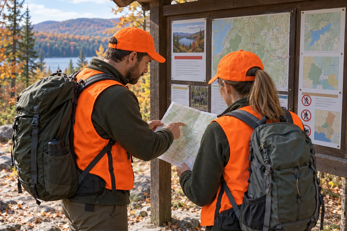
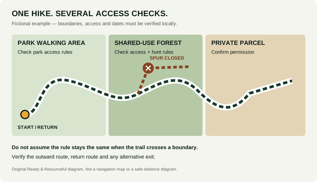
A route may be open to walking while hunting is permitted nearby. Another property may close a trail during a managed hunt. Check the exact place, not just the name of the park.
| Question | Best place to verify | What does not settle it |
|---|---|---|
| May I walk this route today? | Current property rules, alerts, permits and posted closures | An old trip report or app route |
| Is hunting allowed on these parcels? | Land-manager hunting map and property-specific rules | The words “park,” “public land” or “nature reserve” |
| Which hunts are active now? | Current state wildlife regulations plus local hunt notices | Last year’s deer-season dates |
Permission to use one parcel does not establish access to the next. Download a map that shows the entire walk, including the return and any alternate exit.
Ask a question the ranger can actually answer
Instead of “Is it safe to hike there?”, ask: “Is the North Loop open to hikers on Saturday? Does it enter a designated hunt area? Are there managed-hunt closures, and is there an open alternative that stays outside those areas?” Provide the date and route name. A staff member can check access; nobody can promise that every other visitor will behave safely.
Public-land categories also need a closer look. At New River Gorge National Park and Preserve, the National Park Service distinguishes national park areas where hunting is prohibited from national preserve areas where it is permitted. That example is a reason to consult a boundary map, not a rule for every NPS property.
Private-land access is a separate check. A visible path, open gate or nearby public trailhead is not permission to cross someone’s property. If your planned detour leaves an authorized route, resolve access before your trip. In an emergency, prioritize immediate safety and tell responders where you are; do not delay escaping danger to research a boundary.
CHECK 2 / THE SEASON
Look up more than the main deer season
Use the wildlife agency for the state you will actually enter. Select the current license year, then check the relevant management unit or county, species, equipment season and date. A cross-border trail can require two sets of checks. Include the walk back: a route that starts in one jurisdiction may spend most of its mileage in another.
A useful planning note reads “October 31, this property, this management unit, firearms and archery dates checked,” rather than “fall hunting.” Small-game, turkey, waterfowl, special youth hunts and controlled hunts can have different calendars. An archery season can also overlap another open season; the absence of rifle deer season does not establish the absence of firearms.
Choose your time without inventing a safe window
Low light makes people harder to distinguish. A daylight walk with ample time to return can be easier to manage than a predawn start or a late finish. But midday is not a universal no-hunting period, and legal shooting hours depend on the activity and jurisdiction. Ask the land manager about a less busy route or a property where hunting is prohibited if you would rather avoid the overlap.
Check weather and trail conditions at the same time. A supposedly quieter alternative is a poor trade if it adds an icy descent, an unbridged crossing or a return after dark. The day-hike checklist helps cover the rest of the trip rather than letting the hunting-season question consume all your preparation.
CHECK 3 / VISIBILITY
Make the orange visible after you put the pack on
Solid fluorescent blaze orange is an uncomplicated choice for shared hunting areas. Think about the whole dressed hiker, including the rain layer and backpack—not the vest lying on the kitchen table.
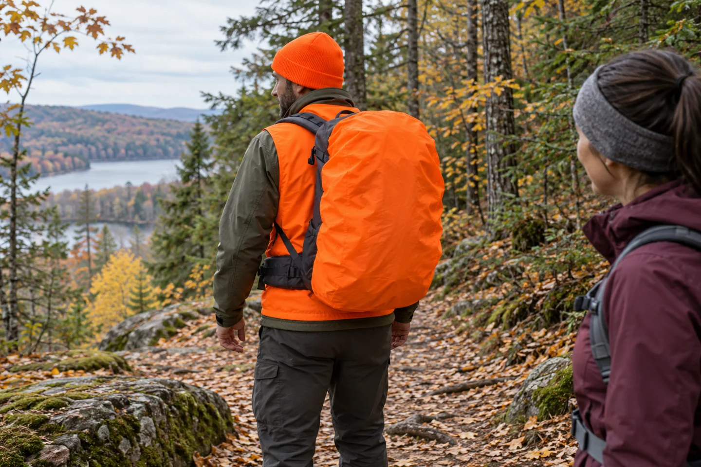
A visible hat
Check that your hood does not cover it. Keep warm and weather-protected; add visible orange to the outer layer.
An outer vest or jacket
Wear it over your hiking layers. A vest hidden under a rain shell cannot do its job.
A visible pack surface
A large dark pack can conceal much of a vest. Add an orange panel or pack cover that stays secure while walking.
Every person and permitted pet
Check each child separately. Keep a dog leashed and visible with a properly fitted orange vest.
Missouri’s non-hunter guidance recommends bright orange clothing, a visible leashed dog and avoiding animal-colored clothing such as tan and brown. It also makes an important point: the responsibility to identify a target and what lies beyond it belongs to the person hunting. A hiker’s clothing never excuses an unsafe shot.
Do not translate a hunter’s clothing requirement into a nationwide rule for hikers. Some places have rules that affect other visitors too, while others give recommendations. Check your property’s requirements. A reflective strip, yellow logo or tiny orange zipper pull is not the same as a broad, conspicuous blaze-orange surface.
Keep your normal hiking essentials. Add visibility to the kit you already need rather than replacing insulation, rain protection or navigation. For pack fit and capacity, see our backpack size guide; whatever pack you use, repeat the visibility check with it fully loaded.
Dogs and children need a plan before the trailhead
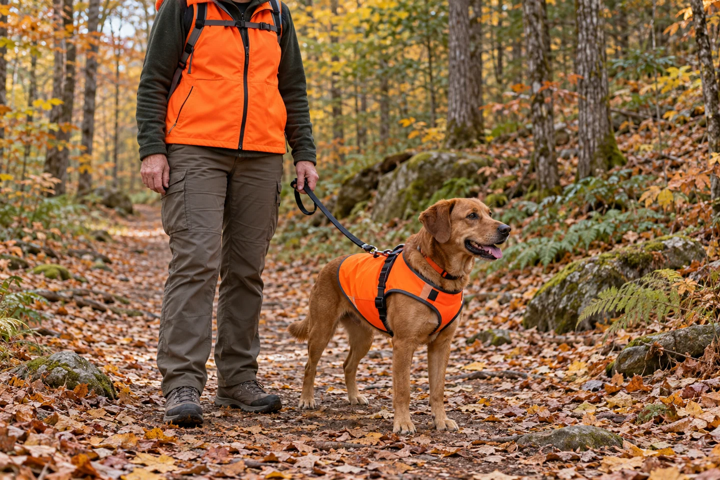
Confirm that dogs are permitted at all, and follow the local leash rule. An orange vest does not make an off-leash dog predictable or override a pet restriction. Do not let a child chase a dog into brush if it breaks away; keep the group together and avoid turning one problem into a search for several people.
Give children a short instruction they can repeat: stay with the adult, stop when the group stops and do not run toward a sound. Agree which adult holds the leash and who keeps the group together when someone checks the map. Those small decisions are easier to make in the parking area than after everyone becomes anxious.
YOUR PRE-TRIP CHECK
Five checks before you leave the car
Tick these as a reminder. This checklist cannot certify that a route is safe. Entries stay in this page session and are not sent to us.
The print button opens a clean checklist and blank trip card. Fill in the location and contacts before your hike; a saved checklist is no substitute for checking fresh notices.
Two route decisions that show why the details matter
Your app shows a loop, but a sign closes the far half
Imagine arriving at a junction and finding a dated managed-hunt closure on the next segment. The app still shows the full loop. Do not walk past the sign to see how far the closure goes. Check whether a signed, open return is available. If not, retrace the open route you know. The extra mileage already walked is not a reason to enter a closure.
You hear shots beyond a field, and your dog wants to investigate
Keep the dog with you, gather the group and announce that hikers are present if there is no indication of an attack. Do not follow the dog or cross the field to get a better look. Check whether your route goes toward that activity. Choose the known exit if you are uncomfortable; if nearby impacts or threats make the situation an emergency, use the emergency response described above.
These are fictional examples, not reports of specific incidents. Their useful feature is the decision point: you can change a walk before you know every detail. A sensible exit usually starts with knowing where you are and keeping the group together.
Questions hikers ask before hunting season
Is it legal to hike during hunting season?
Often it is, but access depends on the property, route, date and current restrictions. A hunting season does not automatically close every trail; an open season also does not override a managed-hunt closure. Verify both land access and the hunting rules.
Should I shout if I hear gunshots?
For ordinary hunting activity without signs of an immediate threat, wildlife agencies recommend using your voice to make your presence known. A clear human call is appropriate. If someone appears to be shooting at people, prioritize escape or cover and emergency help; do not reveal yourself to seek acknowledgment.
How far away is safe if I can hear a gun?
Hearing a shot does not give you a dependable safe distance. Do not use a guessed radius, a sound delay or a quiet interval to clear the route. Check the setting, avoid moving toward the activity and leave if you cannot confidently manage the uncertainty.
Does staying on the trail guarantee safety?
No. Designated trails help keep your movement predictable and reduce unintended entry into hunt areas. They are not protective barriers. Respect closures, remain visible and treat evidence of dangerous shooting as an emergency wherever you stand.
What if I forgot my orange vest?
If the route overlaps hunting and you cannot meet its visibility requirements or recommendations, change the outing. Choose a verified open area where hunting is prohibited or return with suitable clothing. A short hike still involves the same visibility problem.
Could the shots be target shooting instead of hunting?
Yes. A hunting calendar does not tell you every place or time recreational shooting can occur. The Bureau of Land Management publishes shooting rules and directs visitors to local restrictions. Do not assume that public land permits shooting everywhere, or that a particular buffer guarantees your safety.
What if there is no cell service?
Do not assume a 911 call or text will connect. Use your available emergency communication device according to its instructions, if you have one. Do not expose yourself to gunfire merely to reach a signal. Before the trip, download maps and leave a return plan; the Forest Service’s trip-planning guidance emphasizes route familiarity and telling someone where you are going.
KEEP PLANNING
Build the rest of your trail plan
Hunting-season checks belong beside navigation, weather, water and wildlife decisions. Use the guide that matches the next gap in your plan.
Sources and editorial notes
Researched and published October 24, 2026. This guide uses U.S. land-management, wildlife-agency and emergency guidance. It does not provide a live closure feed or determine whether a particular shot is lawful. Check official local information immediately before travel. No original incident reporting, field test or professional review is claimed.
- U.S. Fish & Wildlife Service — Tips for Hunters and Non-Hunters: shared-use conduct and announcing your presence.
- Nebraska Game and Parks — Safety in Parks during Hunting Season: property checks, visibility and low-light considerations.
- Missouri Department of Conservation — Non-hunter safety: clothing, dogs and the hunter’s responsibility. Its archived 2025 season dates are not used here.
- National Park Service — New River Gorge hunting boundaries: an example of different permissions within one named destination.
- Pennsylvania Game Commission — Final 2026–27 seasons: current Sunday-season distinction.
- FBI — Active Shooter Event Quick-Reference Guide: escape, hiding and emergency contact when facing an attack.
- National 911 Program — Calling 911 and calling FAQs: location, call-taker questions and text limitations.
- BLM — Recreational Shooting: activity-specific and local restrictions.
- U.S. Forest Service — Outdoor trip planning: maps, route preparation and return plans.
The hiking images are AI-generated contextual illustrations. The parcel diagram, examples, visibility check, animated video and trip card are original R&R explanatory materials. The video uses synthetic narration; it does not depict a recorded incident. For corrections, see our editorial standards or contact us.
Hunting-season hike: trip card
Date / property / trail: __________________________________________________
Access and current seasons checked: ______________________________________
Return route / alternative: _______________________________________________
Return time / trusted contact: ____________________________________________
Local non-emergency contact: _____________________________________________
Coordinates / format: ___________________________________________________
Immediate danger: escape safely or seek cover; call 911 when safe. Provide your location and observations. Do not investigate. Full guide: readyresourceful.com/outdoor/hiking-during-hunting-season/